River Elwy Catchment (2015)
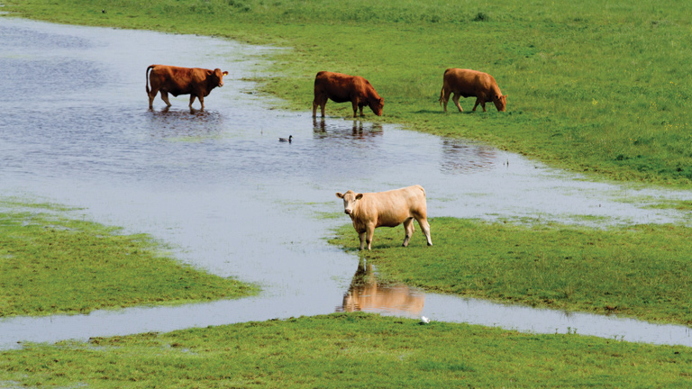
Natural flood risk management (NFRM) is increasingly seen as a valuable addition to conventional flood protection approaches. It is being trialled across several catchments in the UK; however there is currently no spatially integrated approach to assess the relative impact of combined measures across a catchment. An integrated approach to evaluating the flood risk benefits of NFRM has been developed, along with approaches to monitoring, and applied to the River Elwy catchment in North Wales. It is understood that NFRM could complement existing traditional flood defence assets by making the catchment more resilient to climate change. This added resilience allows the engineered works to maintain its standard of protection, e.g. 1 in 100 years, for longer. Incorporating NFRM measures can also provide wider benefits such as improved ecological habitat and water quality, as well as added amenity value. NFRM is part of a catchment-wide approach to flood management that is currently being explored by Natural Resources Wales.
The River Elwy catchment
The Elwy is the largest sub-catchment of the Clwyd catchment in North Wales. The confluence of the Afon Elwy with the Afon Clwyd is downstream of St Asaph. The Afon Clwyd discharges to the Irish Sea, as shown in Figure 1.
The main branch of the Afon Elwy is situated in a flat bottomed, U-shaped valley with a floodplain of agricultural land and some woodland. The in-channel morphology is characterised by pool and riffle sequences with some evidence of wandering channels in the more upstream sections. The downstream tributaries are characterised by confined, heavily wooded valleys, opening out into agricultural areas at the upstream extents.
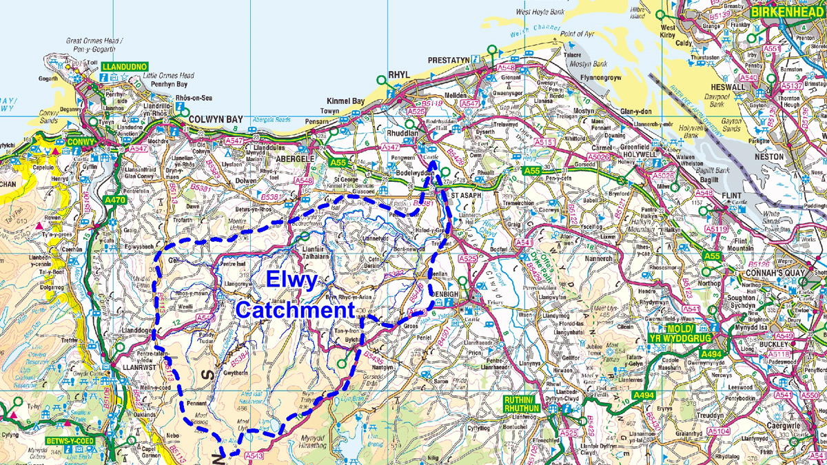
Figure 1: River Elwy Catchment – Courtesy of AECOM
Approach
The Elwy catchment study combined geomorphology with ecosystem services analysis to identify a long-list of approximately 400 opportunities for NFRM within the catchment. Readily available data, including LiDAR and web-based aerial photography, was utilised to identify these opportunities.
Each opportunity was ranked by both the potential for flow attenuation and the constraints to implementation. High ranking options were short-listed to be investigated further using hydraulic modelling techniques. A hydrologic and hydraulic flood routing model was developed to analyse the effectiveness of the options to reduce peak flows in the downstream parts of the catchment.
This approach to the analysis of NFRM within the Elwy catchment provided a rapid technical assessment of suitable measures and the subsequent potential benefits. This evidence base is critical to secure support within the community and to access funding to take NFRM approaches forward.
Identifying NFRM measures
Blue-green infrastructure, sustainable drainage and water sensitive urban design are all important elements of managing water sustainably in the urban environment. NFRM is a sustainable catchment-based approach that complements this more localised sustainable water management in our towns and cities. The natural landscape plays an important role in managing water.
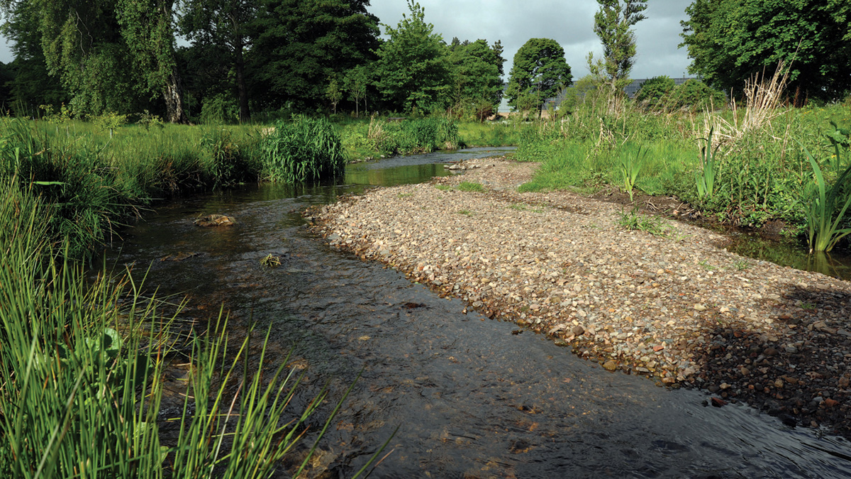
Wetlands/backswamps – Courtesy of AECOM
NFRM uses natural features, such as wet woodland planting, to store or slow down the flow of water before it reaches communities downstream. NFRM can provide multiple benefits over traditional grey, engineered solutions, enhancing the natural environment while also providing reduced flood risk to the built environment. Benefits include:
- Increased bio-diversity through river restoration.
- Green networks through riparian vegetation and native species buffer strips.
- Healthier moorlands through moorland grip blocking.
- Water supply to farms.
- Reduced fine sediment loading to rivers.
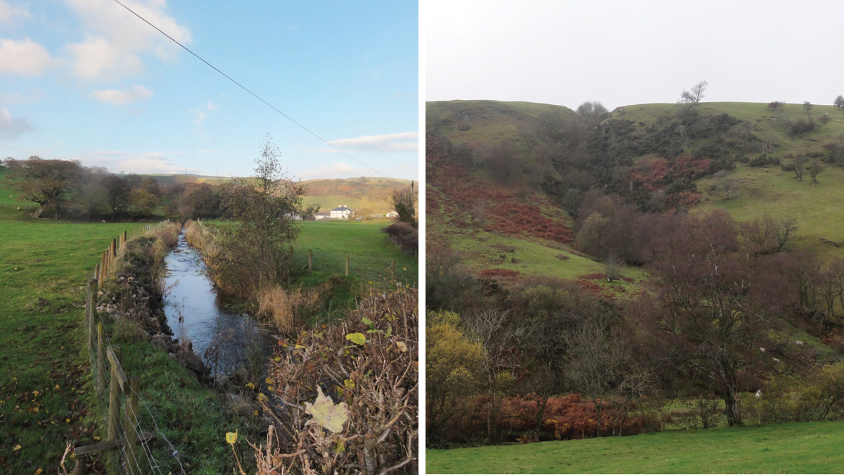
(left) Riparian tree planting/grass buffer strip and (right) Gully planting – Courtesy of AECOM
NFRM is focussed on small scale, incremental increases in flood storage throughout the catchment using natural processes. Working within the constraints of current land use and morphological features, NFRM is about providing a range of flood risk management measures that can be integrated within the landscape. NFRM measures range from:
- Upper catchment afforestation.
- Moorland restoration, including grip blocking.
- Gully planting.
- Floodplain woodland planting.
- Riparian planting.
- On farm storage.
- Wetland creation.
- Re-introduction of morphological changes to the river channel.
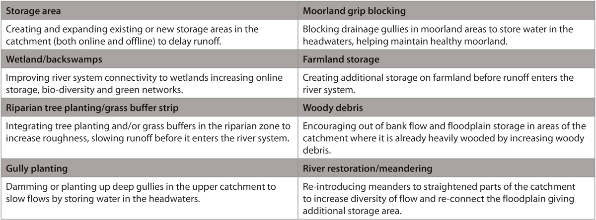
Examples of NFRM measures.
Analysing NFRM
The current evidence base on the effectiveness of NFRM is limited, particularly for larger catchments such as the Elwy. The successful implementation of NFRM therefore requires a robust technical assessment to understand how NFRM will reduce flood risk, providing key information for strategic decision making and to secure funding. The Elwy study has integrated geomorphological understanding, hydrological and hydraulic modelling with ecosystem services to test natural flood management options that provide multiple benefits.
The strategic analysis of NFRM within medium to large catchments needs to critically assess the catchment response, contribution of each sub-catchment to peak flows and the timing of peak flows in communities downstream. The catchment response is a function of key catchment characteristics such as slope, soil, land-use and travel time through the catchment system.
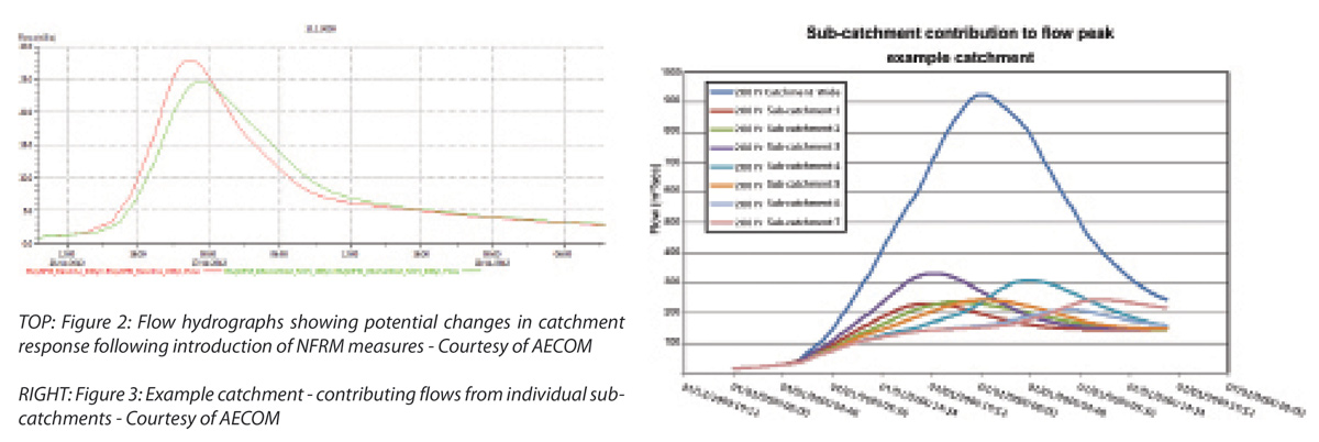
(left) Figure 2: Flow hydrographs (right) Figure 3: Example catchment – contributing flows – Courtesy of AECOM
Figure 2 (above) shows an example flow hydrograph from the Elwy catchment clearly demonstrating the potential change in catchment response following implementation of NFRM measures, with a delay and reduction in flood peak.
Implementation of NFRM measures need to be carefully considered across the whole catchment scale to ensure flows from sub-catchments are de-synchronised to reduce peak flows downstream.
Figure 3 (above) shows examples of modelled flow hydrographs for an example catchment, as well as contribution and timing for individual sub-catchments.
This graph highlights that if NFRM is implemented in sub-catchment 1 and 3 there is a risk of synchronisation of peak flows and therefore increased risk of flooding downstream. This strategic review of catchment response can be used to target NFRM within specific sub-catchments to de-synchronise peak flows downstream, ensuring that NFRM contributes to reduced flood risk.
A routing model of the Elwy catchment with hydrological inflows and representations of the channels was developed based on LiDAR data and FEH catchment descriptors. The model was developed using InfoWorks RS modelling software and included ReFH hydrological inflow boundaries and routing channel sections of the main reaches of the Elwy and sub-catchments including the Aled, Meirchion, Cledwen, Gallen and Barrog. The model was compared to the November 2012 flood event (calculated to be greater than a 1 in 100 year event) to ensure a robust representation of flows within the catchment.
The hydraulic model of the November 2012 event, together with a series of four design events, made up the baseline to test the NFRM options against. This model formed the basis to test the effectiveness of NFRM measures in reducing peak flows downstream resulting in additional resilience, complementing traditional flood management techniques.
Modifications were made to the hydraulic model to represent NFRM measures, including:
- Modification of hydrological inflows to represent changes within the wider catchment, or:
- Adjustment of Mannings ‘n’ hydraulic roughness of the channel and floodplain.
These adjustments, where possible, were based on published studies or research.
Multiple scenarios were modelled to optimise flood relief to urban areas downstream. A key part of the assessment was to combine robust modelling with ecosystem services analysis. This approach provided a systematic review of options and the degree to which they provided multiple benefits. The modelling results for the Elwy catchment indicate that implementation of NFRM within specific sub-catchments reduces flood risk locally.
There is also some reduction in flood risk further downstream in St Asaph, with upper-catchment NFRM measures delivering the most tangible benefits in this catchment.
Ecosystem services analysis
An ecosystem services analysis was completed for the various different NFRM measures that were considered in the Elwy catchment. The analysis shows a positive or neutral benefit to all ecosystem service measures with the exception of food provision. Delivering ecosystem benefits will enable Natural Resources Wales to deliver some of its statutory duties under the Water Framework Directive, Habitats Directive and Flood Directive, amongst others.
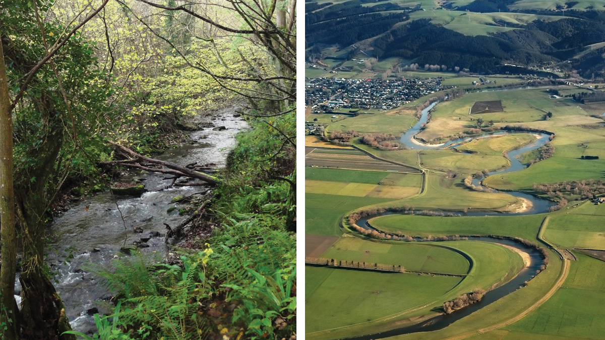
(left) Woody debris and (right) River restoration/meandering – Courtesy of AECOM
Monitoring
NFRM has been applied in smaller catchments and monitoring is being undertaken to capture any impacts to flow. NFRM schemes, such as studies at Belford, Pickering and Pont Bren, provide some evidence of effectiveness and this data will contribute to the future evidence base for specific approaches. This evidence base is critical to secure support within the community and to access funding to take NFRM approaches forward.
To robustly measure the changes within the Elwy catchment both the scale and resolution of monitoring, and the metrics to monitor need to be understood. Repeatable, cost effective monitoring can include simple approaches such as photo points for time lapse analysis, ecological habitat survey and aerial survey. Collecting monitoring data for a period of a few years prior to implementation of NFRM is an opportunity to develop a robust baseline, from which improvements can be measured against.
Different types of monitoring include:
- Hydrometric monitoring: Focusing on using existing and installed flow and stage monitoring gauges within the catchment. The focus of this type of monitoring is to understand the flow response within the catchment.
- Unmanned aerial vehicle (UAV) aerial survey: This provides a baseline and snapshot of reaches of the catchment through collection and processing of aerial imagery to generate terrain/land form data. Repeat surveys generate a photographic and terrain record, recording changes in channel and floodplain morphology and identifying changes in specific habitats.
- Ecological habitat surveys: These are more focussed on measuring the type and number of indicator species within specific reaches of the catchment. This approach is more focussed on identifying ecological response to NFRM.

UAV aerial survey drone – Courtesy of University of Salford
Conclusion
Although the primary driver for NFRM is to reduce flood risk and provide additional resilience to maintain the standard of protection for communities downstream, there are multiple benefits of NFRM across the wider catchment.
Implementation of NFRM within the Elwy needs to be carefully considered and targeted within specific catchments. The analysis indicates there are multiple benefits to the implementation of NFRM within the catchments and also opportunities to undertake monitoring to measure the catchment response as NFRM is implemented.
Strategically reviewing how NFRM will be implemented within a catchment is critical to ensuring reduction in flood risk. AECOM’a s rapid assessment of catchment characteristics, flows and response provides a robust approach to reviewing NFRM opportunities.


