Marhamchurch SPS (2023)
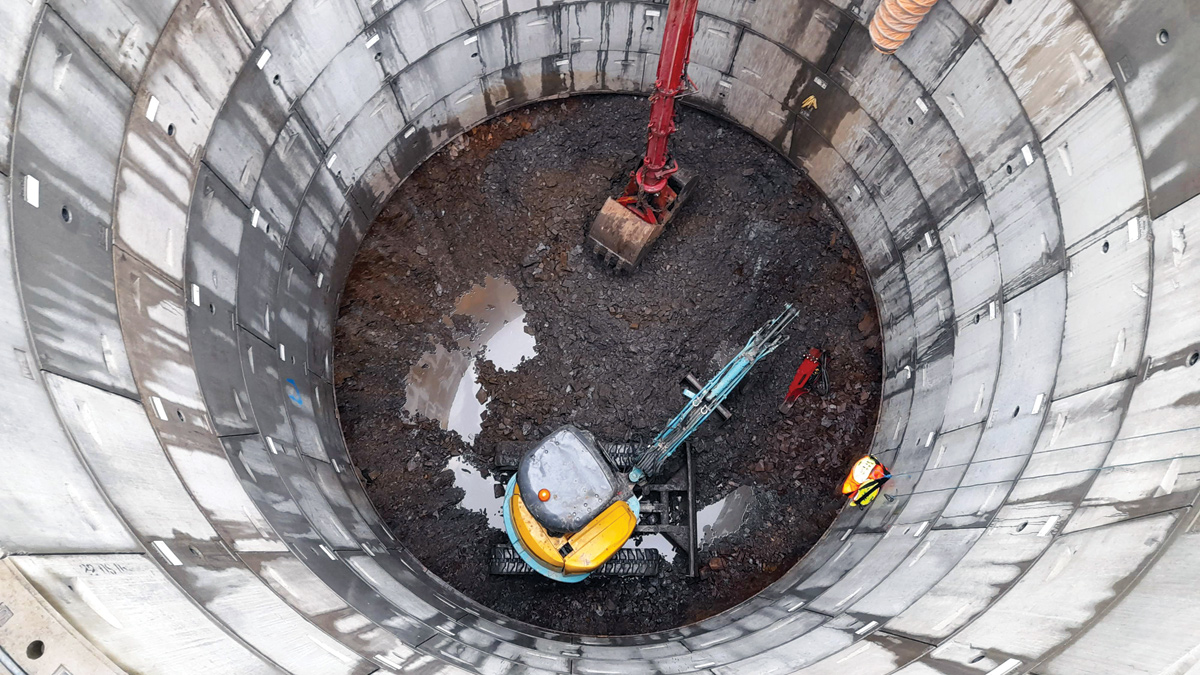
Shaft excavation with mini digger feeding grab - Courtesy of Galliford Try
Marhamchurch is a small village around 2.4km south of Bude and has a population of just over 800. Sewage from this village is pumped to a nearby large sewage treatment works which processes the waste from Bude and the surrounding area. The existing Marhamchurch Sewage Pumping Station (SPS) was built around 50 years ago and was not designed to hold the volume of stormwater nor pass forward the volume of water which is now required to achieve the bathing water quality driver. Marhamchurch SPS does have an emergency overflow which connects to the River Neet and it is this river which discharges into the Bude bathing water area. South West Water had a driver to ensure a design standard of no more than an average of two significant (>50m3) spills per bathing season (as per the Environment Agency definition).
Solution
Galliford Try was appointed by South West Water to find a solution to meet the bathing water driver. A two-fold approach was undertaken; namely to increase the pumping station’s pass forward flows from the current 8 l/s to 18 l/s, and to provide a new pumping station which would contain 100m3 of on-site stormwater storage and thus reduce the likelihood of having to utilise the pumping station’s emergency overflow. The increased pass forward flow rate and on-site storage capacity was based on a 2050 design horizon.
The existing Marhamchurch SPS sent flows to Helebridge STW via a now mothballed sewage treatment works at Helscott, which had been turned into another sewage pumping station. Not only was this a very convoluted route for the flows to take as they were pumped in the opposite direction to the Helebridge STW, but the existing pipe diameter and condition did not lend itself to accommodate the increase in flows. The solution was to therefore lay a new rising main from the Marhamchurch SPS and connect into the existing Helscott Rising Main heading to Helebridge, thereby removing the ‘dog leg’ section of existing pipework.
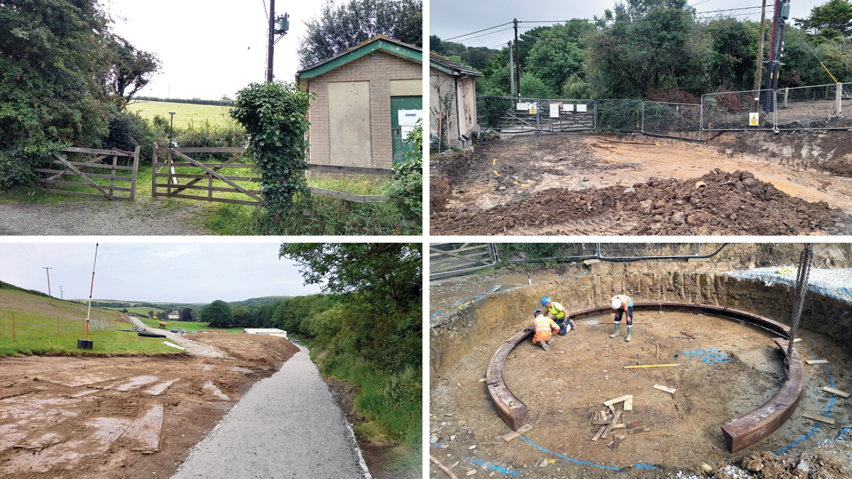
(top left) Existing site prior to improvement works, (top right) site clearance, (bottom left) construction of temporary footpath and haul road to shaft and (bottom right) shaft cutting edge construction – Courtesy of Galliford Try
The new pumping station
The existing Marhamchurch SPS site is on a very small parcel of land which could only be accessed down a narrow un-metalled lane, with low hanging trees. It would not have been possible to send construction plant down this lane, however the adjoining landowner (farmer) was more than happy to allow access to his fields to undertake the improvement works to the pumping station. With easy access now available from the A39 (main road) a shaft solution was adopted for the pumping station storage solution.
A 6.4m diameter shaft would just fit on the existing South West Water plot of land adjacent to the existing control building which, at just under 9m working depth, would provide the additional storage volume required for this project.
The shaft would house new pumps and with a vehicle rated cover slab installed, parking would still be available for the South West Water maintenance teams. The shaft was located on the opposite side of the site to the incoming flows and existing wet well. The existing pump dry well was positioned below ground between this existing wet well and the new shaft, so the solution was to core holes through the dry well and pipe the incoming flows through and into the new shaft. This meant that the limited wet well capacity could also be used for stormwater storage and by raising the existing emergency overflow screen within this existing wet well chamber, the overall shaft depth could be reduced to just under 9m depth as previously mentioned and thus saving money and reducing construction related CO2 emissions, compared to a solution which did not utilise the existing asset storage capacity.
Marhamchurch SPS: Supply chain – key participants
- Client: South West Water
- Project design & delivery: Galliford Try
- Shaft construction: Active Tunnelling Ltd
- Horizontal directional drilling (HDD): Gmac Utilities Ltd
- HDD equipment: Ditch Witch UK
- Temporary works/shoring: MGF Ltd
- Pumping: Pump Supplies Ltd
- Control panel: Galliford Try
- Screens with lifting system: Eliquo Hydrok Ltd
- PE pipe: Jewson Civils Frazer
- Pumps: Xylem Water Solutions
- Precast concrete: FP McCann
- Slurry recycling plant: Gmac Utilities Ltd
- Shaft steelwork: Galliford Try Fabrications
- Bulk materials: Steve Wills Haulage
Shaft construction
Active Tunnelling Ltd was engaged at the pre-construction phase for the shaft construction works which included full design and installation of the shaft and the corresponding cover slab.
To ensure ease of construction, a haul road was cut through the adjoining field from the existing gate access to the works area. The field was steeply sloped and therefore the haul road had to be cut into the slope to follow the natural ground contour to provide safe access for road going vehicles such as concrete lorries, articulated delivery lorries and cranes.
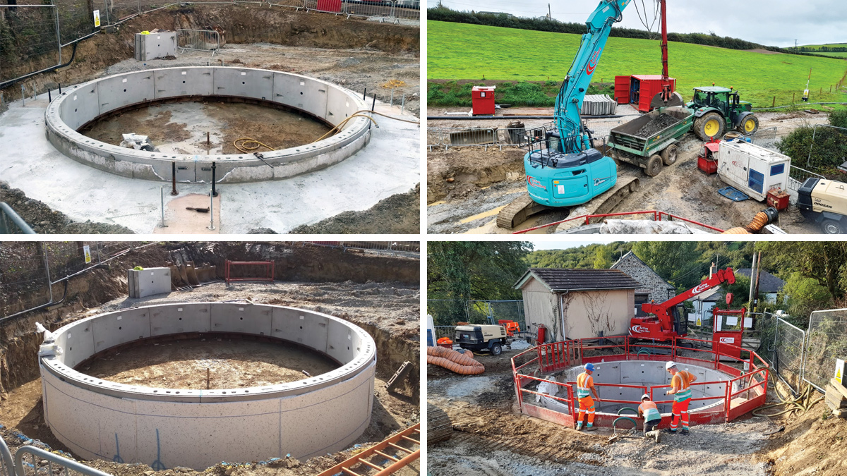
(top left) Shaft collar constructed ready for sinking, (top right) shaft excavation with 27t excavator, (bottom left) first ring constructed ready for casting concrete jacking collar and (bottom right) shaft sinking in relation to public footpath – Courtesy of Galliford Try
Ground conditions as identified in the borehole logs indicated a few meters of made ground and sub soil overlaying the Bude Metasandstone formation. The Bude formation had a reputation of being very hard and competent in places so Active Tunnelling Ltd opted to sink the shaft as a caisson with the option of underpinning if it could no longer be pushed down. Thankfully at this location the Bude formation did not prove too much for the excavators used to sink the shaft and it was successfully sunk as initially planned.
The arisings were removed from the shaft using an excavator mounted grab, before being loaded onto a tractor and trailer and tipped for drying further down in the field located adjacent to the pumping station.
One of the most challenging activities associated with the shaft was construction of a crane pad for the roof slab installation. A 180t mobile crane was needed to offload and install the various precast concrete panels which made up the shaft roof, however as the field was sloping steeply near the working area, a significant cutting around 3.5m deep had to be made in order to create an area level enough for the crane to set up on. Groundwater also became an issue at the cut edge into the hill and a drainage system had to be installed to divert the groundwater away from the crane pad to comply with the temporary works requirements on the design.
The new rising main
From the new shaft pumping station the rising main route was quite obvious. It would pass through two fields on the east side of the A39 before passing below the A39 and the River Neet, then connect into the existing rising main from Helscott to Helebridge, located on the western bank of the River Neet.
The River Neet is classed as a major river and the connection point was on a designated flood plain so confirmation was obtained at pre-construction phase with the Environment Agency that they had no objection to the proposed solution, construction method and that South West Water’s statutory undertaker rights were applicable. Similar permissions were obtained from Cornwall Council for installation of the rising main below the A39.
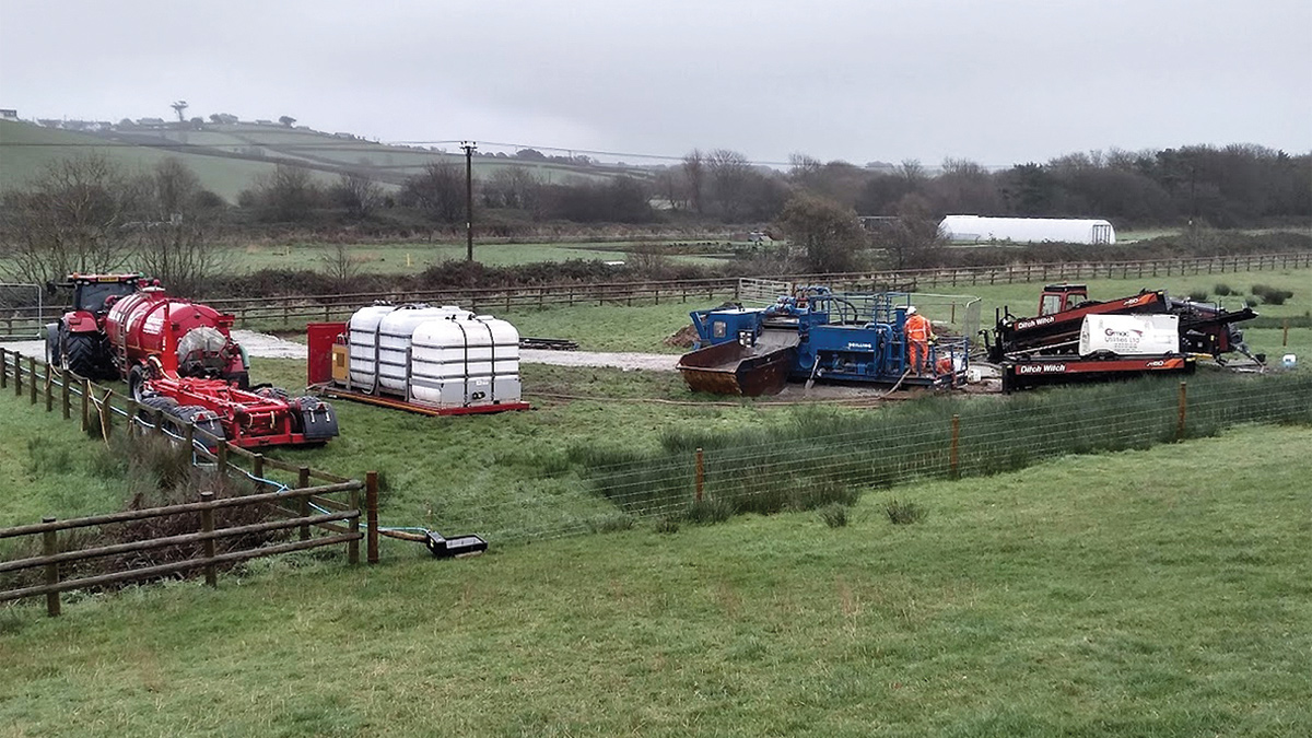
Directional drilling with slurry recycling operation – Courtesy of Galliford Try
The river and A39 were not to only obstacles to overcome in this local area, there were sensitive fibre optic cables and also a medium pressure gas main. The chosen solution to overcome these obstacles was to directionally drill into the Bude Metasandstone and pass below everything at varying depths agreed with each stakeholder. Due to the location of the directional drill and also working on a flood plain next to a tourist ‘hotspot’, it was decided to minimise the construction site footprint west of the A39 as much as possible. To achieve this a slurry recycling plant was used to process drilling arisings with the processed arisings loaded straight into site dumpers and taken off to the tip.
The rising main itself was 180PE pipe which was butt fusion welded in advance of the drilling operation. The initial plan was to directionally drill the entire 486m of rising main however the Bude Metasandstone is a very strong rock and in places was less than 600mm below the field surface. The Gmac Utilities Ltd directional drilling team successfully drilled the road and river crossing at depth however the remaining section of rising main which was located at the interface between the sub-soil and the Metasandstone was almost impossible to control the drill line and level. It was therefore decided that traditional open cut excavation methods would be used to complete this section of the rising main.
Environment
This project was ultimately driven by the need to improve the environment through the improvement of the local bathing water quality. Prior to works commencing a thorough environmental, ecological and habitat survey was undertaken to ensure the project would have minimal impact on the surrounding area.
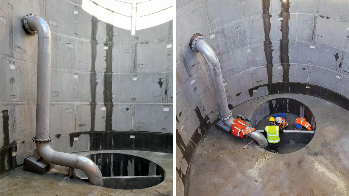
(left) Shaft drop pipe and pump sump with baffle plate and (right) shaft fit-out – Courtesy of Galliford Try
At pre-construction stage it initially made sense to locate the new pumping station on the western side of the existing building next to the existing wet well however this would have meant the felling of a very large and mature Ash tree (showing no signs of Ash die-back) and would have also resulted in around 2m of the new structure being visible above ground, due to its location on the downward side of the boat lift incline. Both the felling of a mature tree and the visual impact of a structure at this location was deem too significant to ignore and by moving the new pumping station location to the east of the existing building, constructability improve and therefore cost reduced.
An existing hedge bank and a few immature trees had to be felled in order to allow access to the site to undertake construction works. A replacement Cornish hedge bank was constructed to replace what was lost at the end of the project and replanted with native hedge and tree species with the aim of improving what was removed once the young plants had established.
Stakeholders
From pre-construction phase through to completion, keeping key stakeholders informed of the works was identified as critical for the successful delivery of the project. A dedicated Galliford Try Client Liaison Officer was allocated to the project and the local village was informed of works through information signs, letter drops and information posted in the local village shop. The existing pumping station was located on a popular locals and tourist footpath which followed the old Bude canal system, with its location positioned half way up an old canal boat lift. A public information board was positioned at this location and was aimed at providing some basic information to tourists who were walking past the site.
The local landowners were personally kept informed of progress by the site team and a great working relationship was established which resulted in successful reinstatement and handing back of the farmland following project completion.
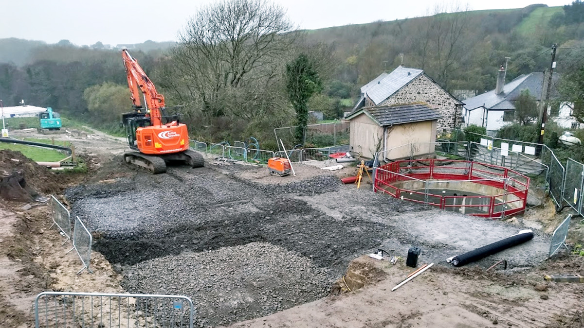
Shaft crane pad construction – Courtesy of Galliford Try
Through this close relationship, one of the landowners asked that a manhole cover be removed following abandonment of the soon to be redundant rising main and the site team suggested that they could fill in and re-profile a small depression left following the removal of an overhead power cable pylon. A few little gestures such as these went a long way with the landowner and were not underestimated by the site team.


