Cownwy & Marchnant WFD Project (2021)
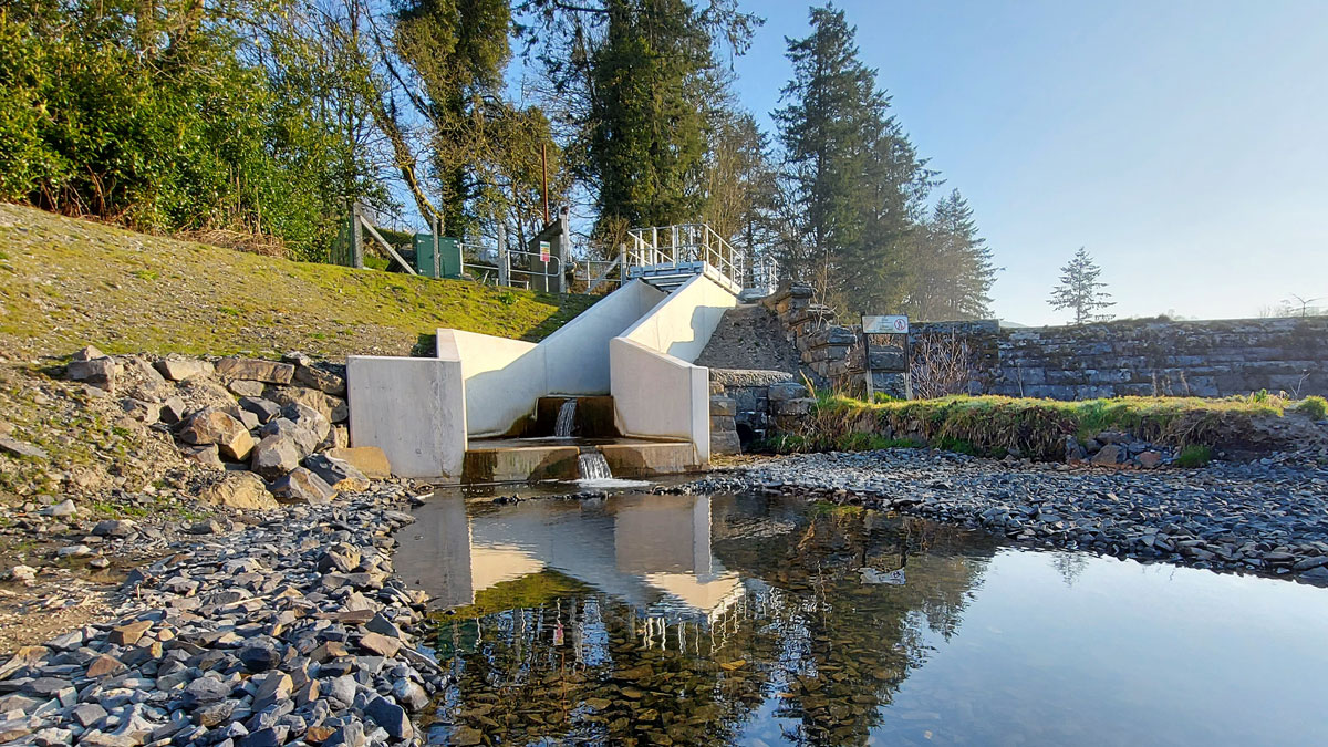
Marchnant Intake - downstream river channel - Courtesy of nmcn PLC (now Galliford Try)
The River Marchnant and River Cownwy lie within the valley of Lake Vyrnwy, Powys. The purpose of this project is to provide environmental flow releases below the Cownwy and Marchnant diversion intakes that supply Vyrnwy Reservoir. The scheme will amend the existing structures to enable a 25/75% proportional flow split, including a Q99 hands-off flow. This will result in 25% of flow being released downstream into the river channel. The restoration of flow resulting from the proposed works is considered to be a significant benefit to the water environment. This project required modification works to two river abstraction weirs. Although similar in nature, both sites presented their own individual challenges and design complications which the following study will review.
Marchnant Intake
Situated along the River Marchnant is a 5m high, 26m long masonry weir which started operation on the 16 March 1910 for the Liverpool Corporation Waterworks. The purpose of the weir was to divert a catchment area of 7.3km2 to Lake Vyrnwy via a 2.13m diameter, 2km abstraction tunnel located along the north shore of the impoundment. At its entrance is a 3.5m wide opening structure which pre-construction, housed a vertical trash screen and large penstock to suspend abstraction when required.
Historically during normal operating conditions no environmental releases to the River Marchnant have been implemented with all flows running via the tunnel to Vyrnwy Reservoir, which during the dryer summer months implies that Marchnant river runs dry downstream.
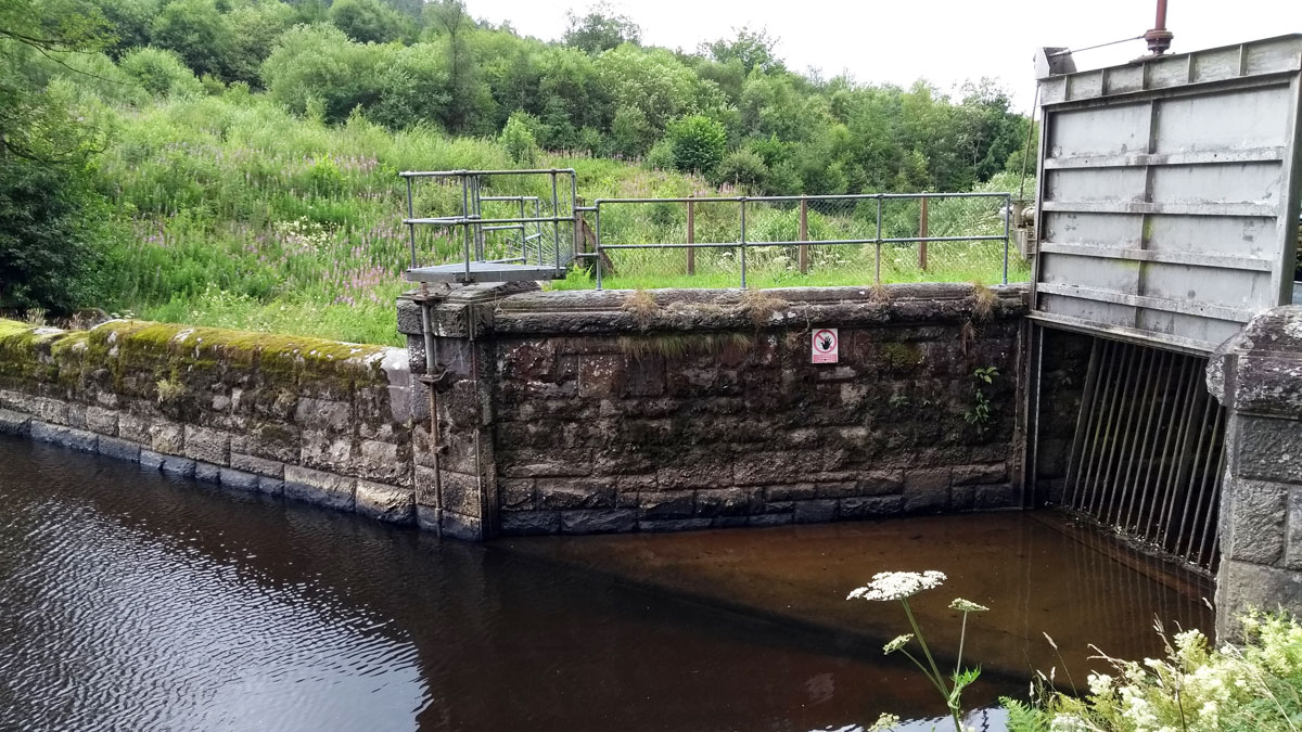
Marchant Intake pre-construction – Courtesy of nmcn PLC
Design
In 2013/14 an independent study was carried out by Grontmij (now Sweco) which included an assessment of proposed solutions to provide environmental flow releases below each impoundment. In August 2017, Jacobs carried out an independent review of this study and submitted a report which documented further investigation into the preferred flow regime and options to divert. The selected regime was a 25/75% split of all river flows at the abstraction points by constructing an upstream flow split weir. In 2019 Atkins were commissioned by nmcn PLC (now Galliford Try) to develop a detailed design based on the split flow proposal, the key objectives and considerations were:
- Design an accurate hydraulic solution that will allow catchment inflows to split 25%/75% within +/- 8% accuracy including a Q99 Hands of flow. The Q99 HoF was stipulated at 0.664 Ml/d, equal to 7.7 l/s.
- The restoration of flow is considered to be an important benefit to the water environment but the lack of a well-defined downstream channel poses some residual risks with erosion and possible starvation from mobilised fine sediment.
- Provision and consideration given to allow safe passage for migrating fish which has not been possible since its initial construction some 110 years ago.
- The existing flow monitoring equipment used by United Utilities for abstraction will become redundant and a new 3 rating curve system is to be implemented to measure QTunnel, QRiver & Q99.
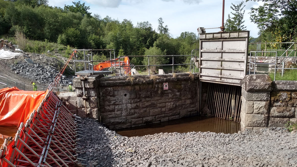
Marchnant abstraction channel and temporary dam – Courtesy of nmcn PLC
The final detailed design which was accepted by the client required demolition works to the existing masonry wall between the existing weir buttress pillar and the abstraction tunnel entrance. This would then be replaced with a new bifurcating concrete structure consisting of 2 number broad crested weirs at 4.95m and 1.65m wide. To reconnect flows back to the lower downstream watercourse a stepped cascading channel comprising of three smaller weirs was also proposed.
Both weirs have the same crest level at 254.51 mAOD, thus giving a flow split proportional to the width of the weirs with 25% of the inflow being diverted to the river and 75% passing to the tunnel for abstraction. This will remain constant under normal flow conditions except during wet weather events where the main weir will become active. For dry periods with river flows smaller than 7.7 l/s, expected to happen 1% of the time, the totality of the inflows will be diverted to River Marchnant through a 75mm diameter orifice plate discharging to a 150mm diameter hole through the river weir.
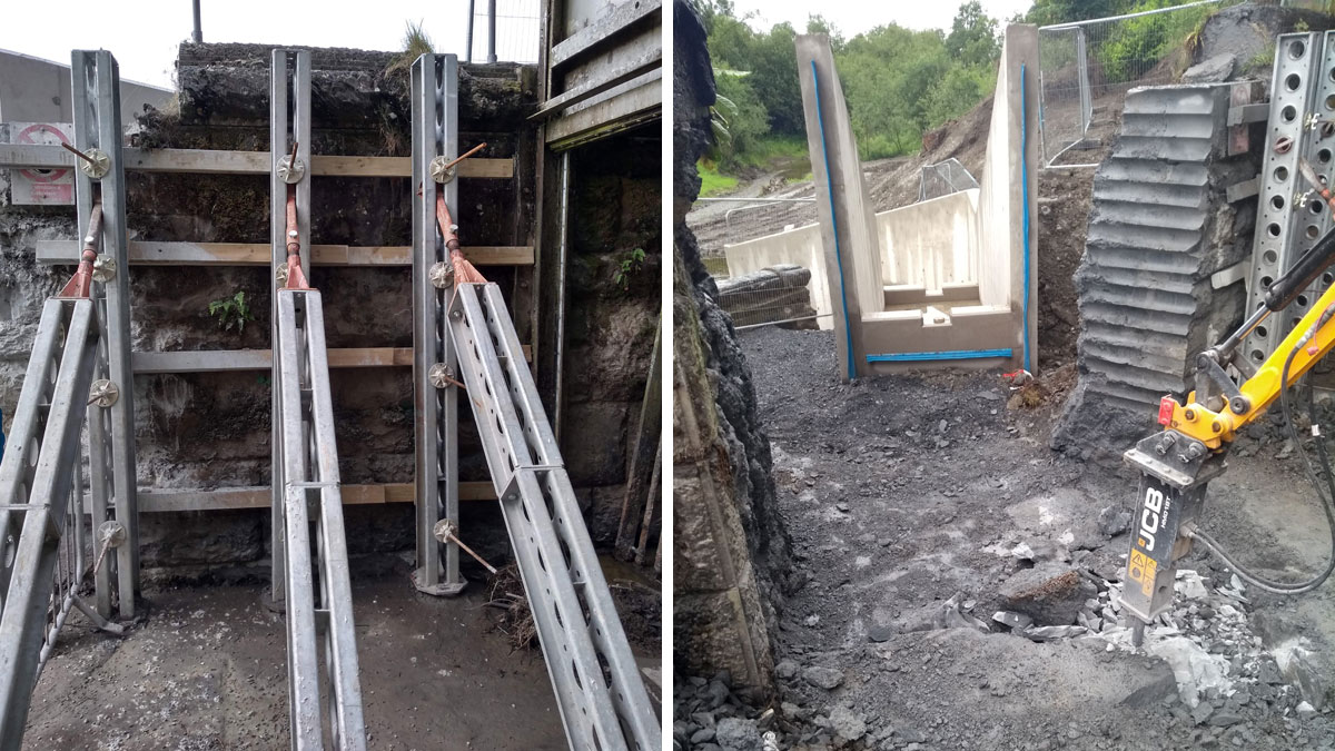
(left) Strong back wall supports and (right) demolished wall section – Courtesy of nmcn PLC
Geomorphological & environmental
The key objective for the project was to introduce continued flows downstream of the weir for improved biodiversity. During the design stage Natural Resource Wales were consulted which highlighted a need to also consider how fish are able to pass through the structure.
The crest level between the new river weir and the lower-level river connection is circa 4m, to allow passage the design incorporated a concrete stepped cascading channel with three 300mm high weirs and centrally located notch. This provides a three-step pool structure allowing any aquatic wildlife to safely pass through each section and re-join the river via a rip rap lined plunge pool at the end of the channel.
A geomorphological study was carried out to report on the forms and dynamics of the existing river channel, the purpose of this detail was to provide a targeted assessment of specific sediment related concerns which could be introduced with the release of higher flows. The existing downstream channel was a stagnant and ponded environment due to the lack of flow with an ill-defined and over grown channel.
This has encouraged a higher-than-expected accumulation of fine sediment and organic matter, culminating in what was assumed to be potentially poor water quality and diverging aquatic conditions away from fluvial to pond and wetland habitats. Without any intervention, the accumulated organic material immediately downstream of the weir would likely be mobilised resulting in potential pollution impacts further downstream.
To mitigate these concerns the proposal was to construct a new channel between the plunge pool and nearest tributary by clearing vegetation, digging out a 1.5-2m wide channel and excavating any pooled organic material at its base. The banking’s were then lined with natural coir mattress and a washed granular substrate placed along the bed. Where notable changes in bed level were present ‘bed checks’ were installed by embedding natural materials such as felled or fallen logs along the width of the channel which would mitigate against base incisions and erosion from changes in flow.
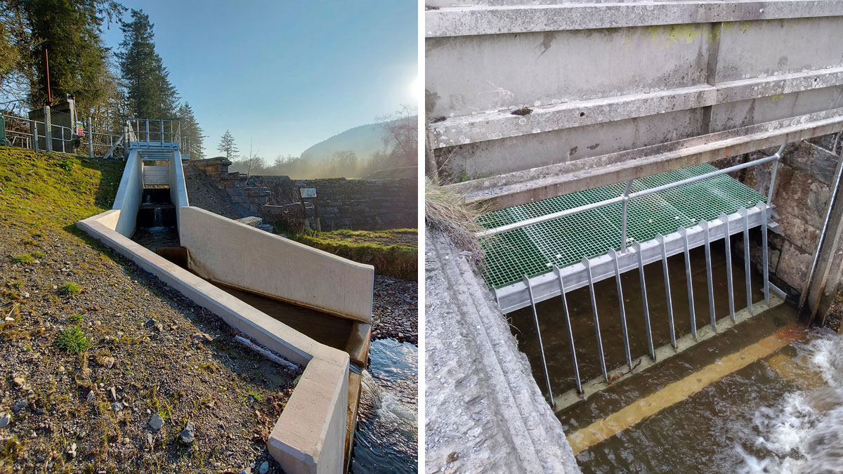
(left) Downstream river channel and (right) trash abstraction screen – Courtesy of nmcn PLC
Construction
Construction of the new weirs and connecting river channels posed a myriad of challenges to overcome as works would be directly within the flows of the River Marchnant with no upstream diversion or isolations possible. To allow access for demolition works to commence a temporary ‘A’ frame dam had to be implemented which was provided by Murlac Land & Marine environmental solutions.
To break through and demolish a section of the Morlach existing wall a bespoke support system had to be designed as the proposed structure was located between two supporting buttress walls which and was at risk of possible collapse or movement if it was left free standing. A strong back push/pull system was implemented in collaboration with nmcn PLC and Whytemount Civils Ltd. This allowed the 2-3m section of wall to be safely stitch drilled whilst the retained section provided support for existing hardware.
All reinforced concrete sections were cast in situ utilising standard industry formwork and steel fixing techniques.
Cownwy & Marchnant WFD Projects: Supply chain
- Main contractor: nmcn PLC
- Design partner: Atkins
- Steelwork suppliers: WJW Engineering
- Steelwork suppliers: HL Engineering
- Stop logs: Glenfield Invicta
- Civils labour: Whytemount Civils Ltd
- Fluvial geomorphologist: Atkins
- Portable dam: Murlac Land & Marine Environmental Solutions
- Temporary works: National Trench Safety UK
- MCERT quality check: Critical Flow Systems
- Monitoring equipment: Vega Controls
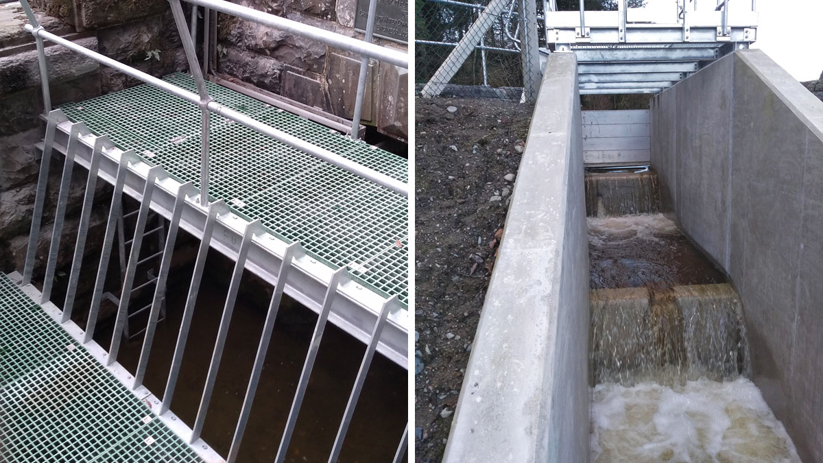
(left) Trash screens and (right) stop logs and river weir – Courtesy of nmcn plc
Commissioning
A flood risk assessment of the proposed flow split was undertaken by Atkins in 2020 and identified a peak flow to the river of 1.13m3/s during a 2-year flood event. To address the increase in flood risk the design incorporated a stop log solution combining a 0.2m lower opening secured to the upstream face of the river weir channel.
This arrangement would reduce peak discharge from a 2-year flood by 50%. (Reduced from 1.13m3/s to 0.62m3/s). The stoplogs will not significantly impact the 25/75 flow split target defined for the project during normal flows, as the aperture is only expected to be submerged for flows larger than 0.4m3/s, which will only happen very rarely.
To release flows a two phased approach was agreed which would then allow downstream flow speeds and river levels to be monitored over a set duration.
The aim of the flow tests is to observe the downstream river levels and behaviour for the flow tests below to confirm that the flow release will not represent a problem downstream. The flow tests will also allow to assess the performance of the new structures.
- Flow Test 1: ~0.2m3/s.
- Flow Test 2: ~0.4m3/s.
Flow tests confirmed that nmcn PLC had achieved the predicted Q99 target with the head of water at the time of testing and no concerns were raised from downstream levels witnessed.
Cownwy Intake
Located on the River Cownwy is a 5m high masonry weir which started its operation in 1910 for the Liverpool Corporation Waterworks. The purpose of the structure is to divert a catchment of 12.9km2 to Lake Vyrnwy via a 3m wide open ‘U’ shaped channel (89m long) which connects to a 2.1m diameter abstraction tunnel (2km long).
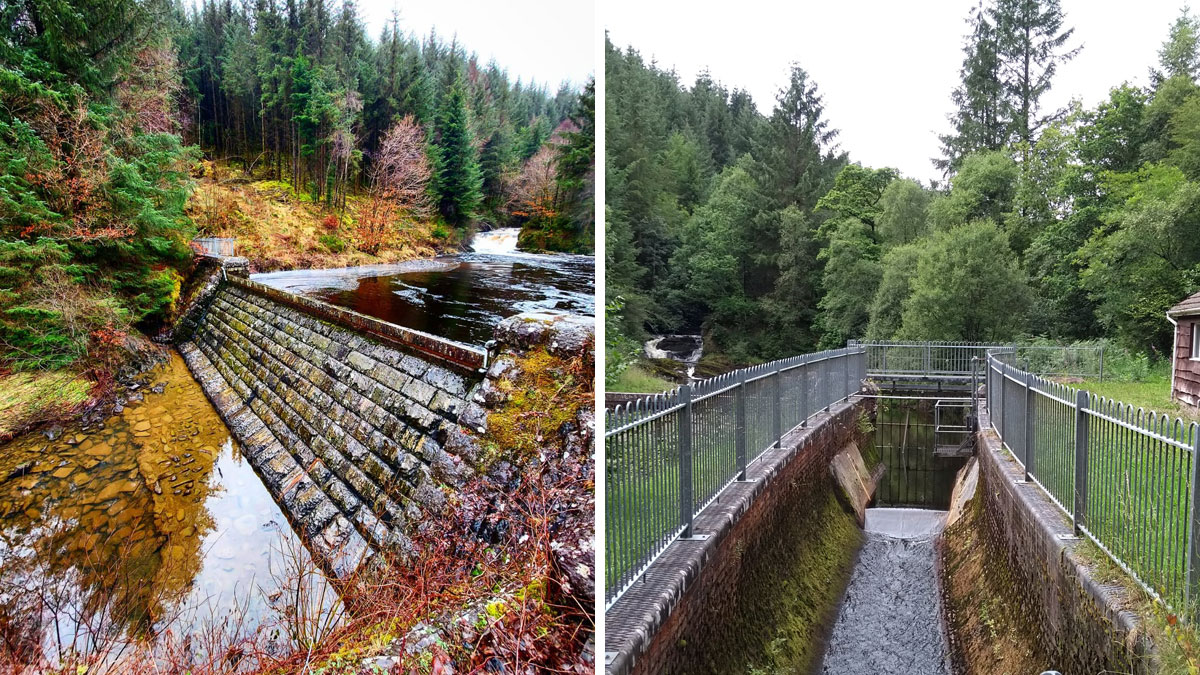
Cownwy Intake pre-construction August 2018 – Courtesy of nmcn PLC
The diversion weir has a 15m wide overtop spillway located between the two main supporting pillars and also includes an emergency scour valve. Much like the Marchnant diversion the Cownwy Intake impounds all inflows upstream with no environmental releases to the River Cownwy downstream. Naturally, this implies that the river has the possibility to run dry during drought conditions.
The aim of the project was to design a method of modifying the existing structure which would maintain operational use for abstraction but also actively release hands off flows back into the river.
Design
In 2013/14 an independent study was carried out by Grontmij (now Sweco), which included an assessment of the proposed solutions to provide environmental flow releases below the impoundment. In August 2017, Jacobs carried out an independent review of this study and submitted a report which documented further investigation into the preferred flow regime and options to divert.
The preferred regime for Cownwy was to construct a new flow splitting structure upstream within the abstraction channel where the existing emergency spillway is located.
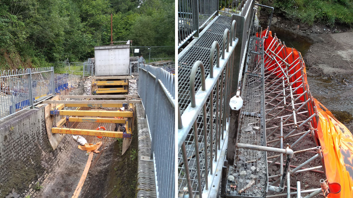
(left) Shoring used for channel and (right) upstream porta dam – Courtesy of nmcn PLC
In 2019 Atkins was commissioned by nmcn PLC under this contract to develop the detailed design, the key objectives and considerations were:
- Design an accurate hydraulic solution that will allow catchment inflows to split 25%/75% within +/- 8% accuracy including a Q99 Hands of flow. The Q99 HoF was stipulated at 2.46 Ml/d (0.028m3/s).
- Provision and consideration given to allow safe passage for migrating fish which hasn’t been possible since its initial construction.
- Inclusion of new monitoring equipment as the existing would now become redundant.
- Replacement of the existing trash screen to a more maintainable structure.
The final detailed design & proposal was to demolish part of the existing masonry abstraction channel and form a new bifurcating rectangular channel which would include two new concrete broad crested weirs (3m wide discharging to the tunnel and 1m wide weir discharging back to the river). Both weirs have the same crest levels, thus giving a flow split of the inflows proportional to the width of the weirs (25%/75%). This will remain constant under normal flow conditions.
Under flood, the channel and impoundment capacities will be reached and the main weir and emergency spillways will be activated increasing flows to the river.
For dry periods with river flows less than 28.5l/s, expected to happen 1% of the time, the totality of inflows will be diverted to the River Cownwy through an opening of 31mm left at the base of the new scour penstock installed within the channel. This discharges to a new in situ concrete culvert channel and connects to the emergency spillway with a stepped/pooled river connection.
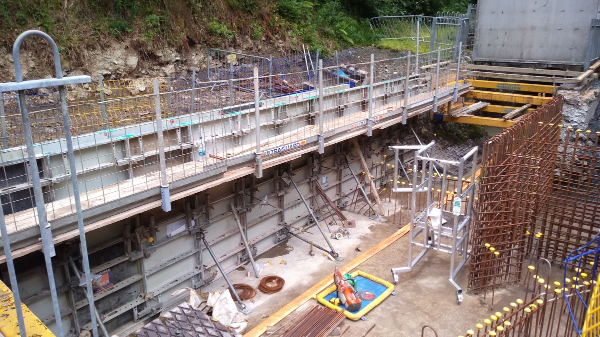
Formwork for channel – Courtesy of nmcn PLC
Environmental
Levels between the initial river weir to the connecting river is were approximately -3m, so consideration had to be given for migrating fish and other aquatic wildlife that may pass through the structure. Working with guidance provided by Natural Resource Wales the final design incorporated an arrangement of five stepped pools, each with a 300-400mm high weir and a centrally located notch. Each weir would then retain a permanent pool to a minimum depth of 300mm even under dry conditions allowing safe passage through the structure.
Protected species
The pre-construction ecological appraisal identified a colony of roosting common pipistrelle bats (Pipistrellus pipistrellus) and soprano pipistrelle bats (Pipistrellus pygmaeus) in very close proximity to the working location. To ensure that the conservation of Habitats & Species Regulations 2017 were complied with, a licence was agreed with Natural Resource Wales and sound/vibration mitigation measures put in place. To assist the colony, nmcn PLC also put in place a number of additional roosting and maternity boxes in and around the woodland area of the project.
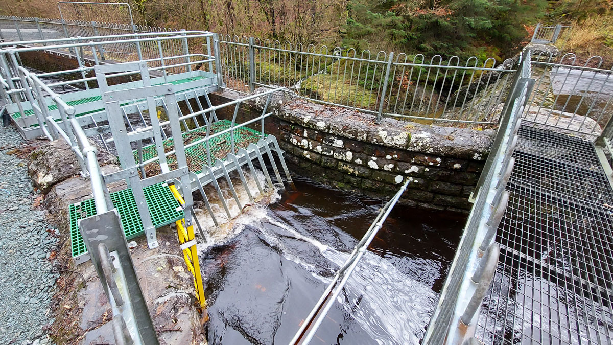
Upstream trash screen during high flows – Courtesy of nmcn PLC
Construction
Construction on the new bifurcating structure commenced with the installation of a free-standing ‘A’ frame portable dam (provided by Murlac) to isolate abstracted flows through the U-shaped channel and retain any incoming flows upstream of the works. This was installed at the opening of the U-channel and inflows were controlled by utilising a series of pumps provided by Selwood.
Construction works required the use of a wide variety of plant which introduced a structural risk to the existing channel when working within close proximity. A temporary supporting system was designed and installed by National Trench Safety by using hydraulic shoring and large sheeting piling. This would protect the open sections of channel from any excessive forces or vibration throughout construction. The new structure was cast in situ with formwork designed and supplied by RMD Kwikform.
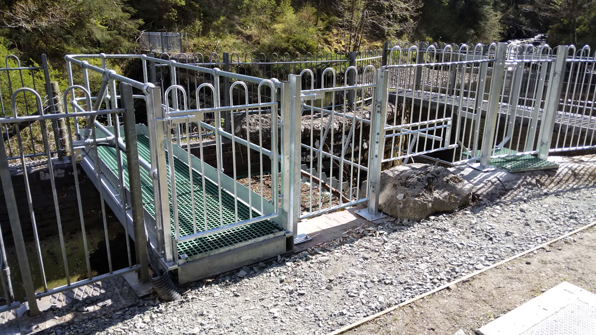
Trash screen entrance – Courtesy of nmcn PLC
Commissioning
A flood risk assessment of the proposed flow split was undertaken by Atkins in 2020. The spillway weir to the River Cownwy starts operating with a flow of 8.70m3/s, which means that it will be overflowing during the 2-year flood (18.2m3/s) and for all larger flood events.
The new split flows were designed to introduce a maximum of 2.2m3/s through the river weir which raised some concerns from local authorities and key stakeholders. Although the risk assessment carried out identified a maximum river rise of 0.04m downstream of the structure a solution was devised to address these concerns.
The modified arrangement included a stop log solution secured within the structure with a 450mm high bottom opening to reduce flows by 50%, from 2.2m3/s to 1.1m3/s.
To release flows a two phased approach was agreed which would then allow downstream flow speeds and river levels to be monitored over a set duration. The aim of the flow tests is to observe the downstream river levels and geomorphological impacts from increased flows. The flow tests will also allow to assess the performance of the new structures.
- Flow Test 1: ~1.1m3/s.
- Flow Test 2: ~2.2m3/s.
Flow tests confirmed that we had achieved our predicted Q99 target with the head of water at the time of testing and no concerns we’re raised from downstream levels witnessed.
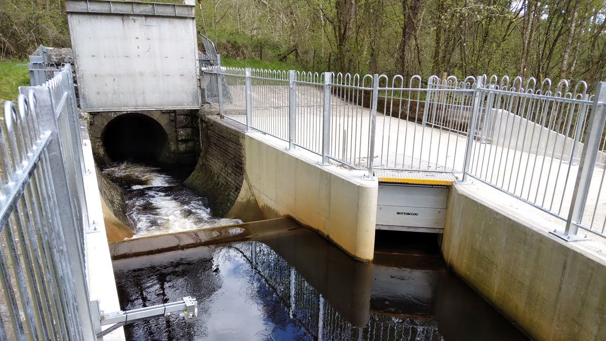
Completed split channel – Courtesy of nmcn PLC
Current Status – June 2021
- Both schemes are complete and running with beneficial use at 25%/75% flow splits.
- Automated flow monitoring has also now been installed at both sites to measure levels for abstraction and reinstatement works complete.
- Vegetation at Marchnant requires some initial monitoring throughout this summer with some minor tree planting works planned for November 2021.


