
Rodway WTW Green Outfall (2026)
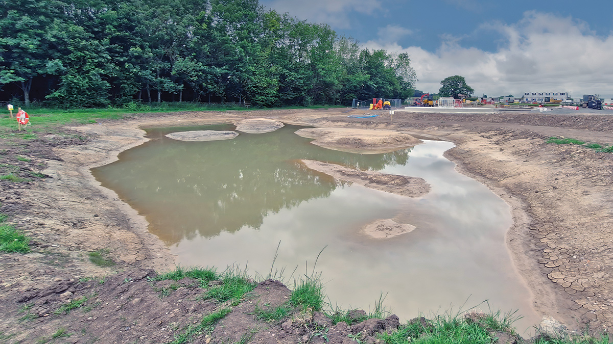
Green outfall under construction - Courtesy of Mott MacDonald Bentley
Operated by Severn Trent, Rodway Water Treatment Works (WTW) was proposed for major capital upgrades to be undertaken from 2025-2027. The treatment works is located north of Telford, in Shropshire. The standard option for infrastructure to direct the run to waste and surface water drainage to the river would have been via buried pipework with associated chambers and headwalls. Although efficient from an engineering point of view, this option provides no wider benefits such as water quality improvement, attenuation and biodiversity. Severn Trent saw an opportunity to design a ‘green’ washout solution for the site that would provide multiple benefits including water quality improvements, whole life carbon savings, biodiversity, flow attenuation and reduce landscape impact of the scheme.
Background
Raw water is sourced from boreholes which require washing out as part of regular maintenance and after any shut down period. This is referred to as ‘run to waste’ as it can contain suspended solids and high turbidity, which cannot be put through the treatment works.
During operation, the borehole abstraction can often shut down at night when there is less demand. This means that run to waste can occur at least once per day prior to demand increasing in the morning and abstraction restarting. Testing indicated that high turbidity can be detected during at least the first 5-10 minutes of running the pumps at start-up.

(left) Simplified arrangement of the green outfall – Courtesy of Mott MacDonald and (right) example of an established wildlife pond – Courtesy of David Naismith
As the run to waste consists of abstracted ground water that poses low to no environmental risk, it will be discharged to the local water course, the River Strine, which flows along the southern boundary of the site. Alongside the run to waste flows, some dechlorinated process wastewater will also be discharged into the river. In addition to these sources, the surface water drainage of the site (including roof and hard standing runoff) will also be directed into the river and requires management via a drainage network.
The standard option for infrastructure to direct the run to waste and surface water drainage to the river would have been via buried pipework with associated chambers and headwalls.
Although efficient from an engineering point of view, this option provides no wider benefits such as water quality improvement, attenuation and biodiversity. Severn Trent saw the opportunity to design a ‘green’ washout solution for the site that would provide multiple benefits including water quality improvements, whole life carbon savings, biodiversity, flow attenuation and reduce landscape impact of the scheme.
An initial design by consultants working on the concept design of the scheme consisted of a green headwall discharging into a meandering swale with check dams, which had to be fitted into a constrained area between access roads.
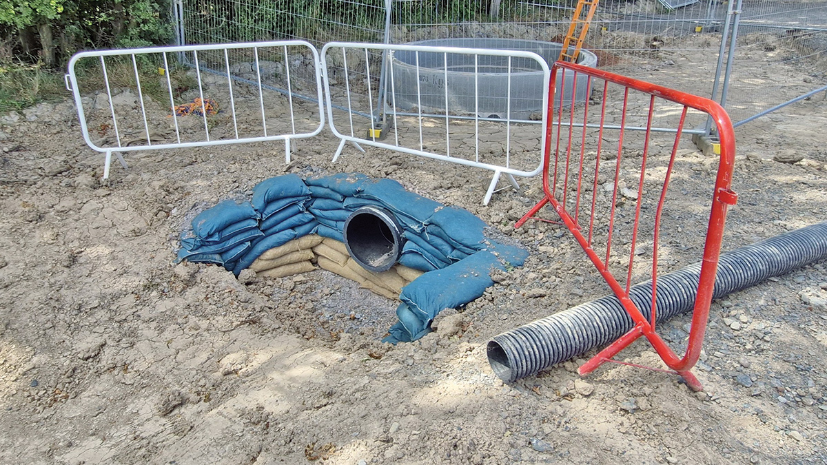
The inlet headwall under construction – Courtesy of Mott MacDonald Bentley
The Environment Agency reviewed the proposals and provided feedback that this option was too engineering-focused and requested a more natural design approach. Severn Trent briefed the MM/MMB design team to develop a design that incorporated a more naturalised approach which delivered multiple benefits. This was to include landscaping to enhance the visual aspect of the site as it can be viewed from a public footpath that follows the bank of the River Strine, along the southern boundary of the site.
Scheme design
Building on concept design work undertaken by others at earlier stages, Mott MacDonald Bentley and Mott MacDonald were contracted to provide design and build services for the scheme.
A rearrangement of the access road layout allowed for a less linear and constrained area to be utilised, and an area that could be dedicated to the green outfall and biodiversity improvements was agreed with the wider design team and the client.
To meet the objectives of the project, the team maximised the opportunity within this space and developed a more natural, flowing design that drew inspiration from a braided, shallow river channel with a combination of deeper pools and small islets that would be partially submerged in higher flow events. In addition to the main channel, a wildlife pond and dragonfly pool were included alongside the main channel, with the wildlife pond connected so it receives some flow in medium to high flow scenarios.
A general arrangement plan for the design was presented to the Environment Agency, project stakeholders and it was used to support the planning application. The Environment Agency was satisfied that the new design met their aspirations for the scheme and approved it to be progressed.
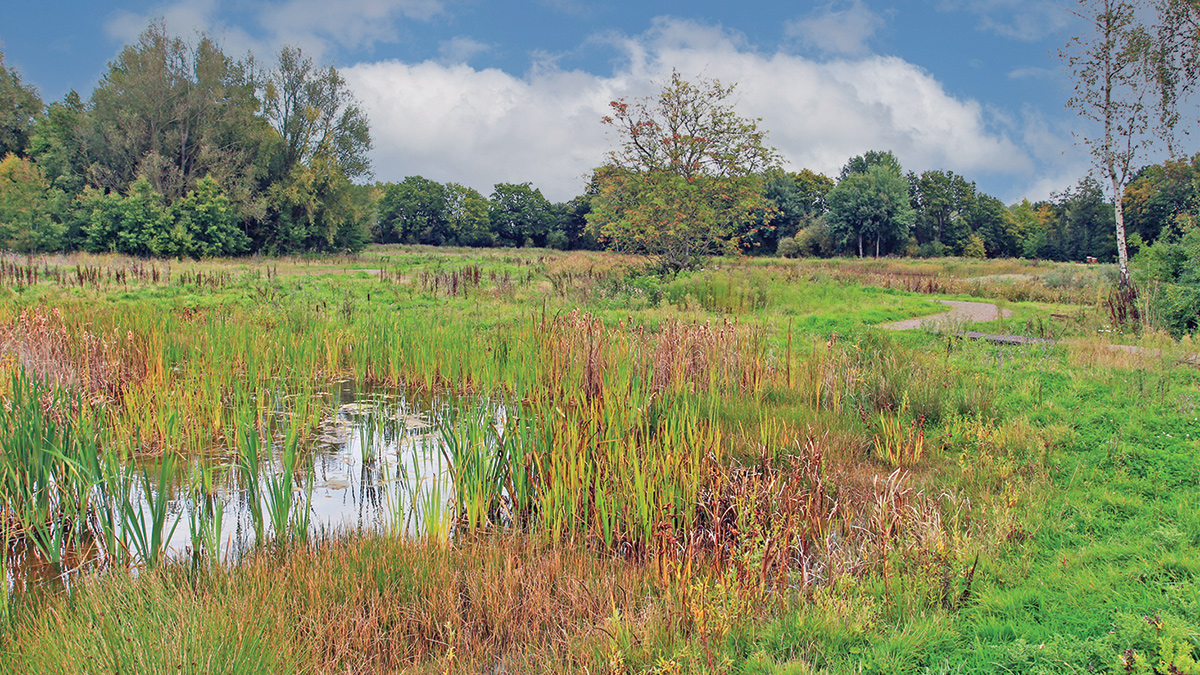
Example of an established dragonfly pool with emergent vegetation around the edges – Courtesy of David Naismith
The main channel
The main channel provides the flow route for the run to waste, dechlorinated process wastewater and surface water drainage out to the river. The flows are highly variable depending on the pump out rate of the boreholes and the time required for the turbidity to reduce sufficiently before it can be sent to the treatment works.
Run to waste flows range from 40m3/day to 12,000m3/day (if the boreholes need to be flushed for an extended period), with a typical flow around 200m3/day. During normal operation it is expected that 200m3/day at an average flow rate of 2.31 l/s will be discharged into the wetland. Dechlorinated process water (from testing points throughout the treatment process) will be up to 4.3 m3/day with an average flow rate of 0.1 l/s.
To reduce the use of concrete and maintain softer landscaping features for the wetland habitats, soil retention bag systems have been specified for inlet headwalls in place of the more typical precast concrete options. This allows for more organic shapes to be created that will follow the angle and curve of the embankment slopes and will green up over time to blend in. This option also reduces the carbon footprint of the scheme, though there are interesting debates underway on the subject of introducing plastics into the environment with some product options. There is a short length of linear wetland, forming the inlet, with a check dam located where the main channel opens out. This check dam retains a minimum water depth of 5cm upstream during no to low flow conditions.
Water depths within the main channel range from 20cm to 40cm, with the maximum depth rising to 50cm in storm conditions. Although a deeper wetland was desirable, the maximum water level was governed by inlet invert levels, and deeper excavation would have resulted in significant volumes of material to be exported off site.
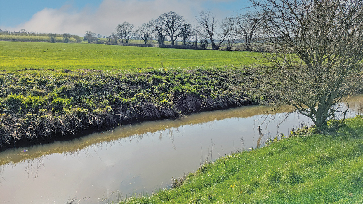
Location of new outfall into River Strine – Courtesy of David Naismith
Small pools have been created to provide deeper water zones with water depths between 70 and 90cm. To provide further variety within the flow path, islets have been formed. Some were designed to be permanently flooded to a shallow depth of a few centimetres while others were designed to extend above the water during most flow conditions, only being partially flooded during high/flood water levels. Pond side slopes are typically 1V:4H or 1V:5H, to provide a more natural fit with the landscape and provide additional space for marginal vegetation.
Trial pits undertaken on site during the design phase indicated the presence of suitable low-permeability clay within the proposed wetland area. This was confirmed by soakaway tests undertaken at the proposed bed level of the wetland and, as a result, an additional pond liner was not required. The use of onsite clay reduced the cost and carbon impact of the scheme.
The green outfall will provide treatment of incoming flows, including reduction of turbidity from the borehole washout water and further treatment of road surface runoff, resulting in higher quality water being discharged to the River Strine.
The outlet of the channel is controlled by a berm that will act as a fixed crest weir that retains water within the wetland during low to no flow. The berm will be formed from site won soils with coir matting to protect it from erosion while vegetation establishes. Instead of a pipe and concrete headwall to outfall into the River Strine, a rock cascade and open channel has been designed to form the outfall of the wetland.
The cascade will be formed from rock weirs 60cm apart with pools in between. Pools and areas between the rock weirs will be filled with river gravel and cobble mix with a final shallow slope of river gravel and cobble mix leading into the river. Scour analysis also showed that, due to the low flow rates from the wetland and energy dissipation provided by the cascade, further protection of the River Strine bed was not required, reducing in-river works and impact. This is due to the design of the wider wetland outfall and cascade reducing flow rates and velocities compared to that of a single pipe outfall.
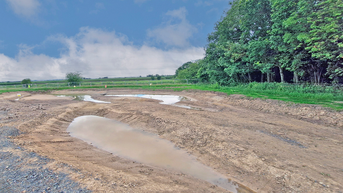
The wildlife pond under construction with the upper shallow side slopes evident – Courtesy of Mott MacDonald Bentley
Wildlife pond
To create a wider range of habitats and support greater biodiversity, a wildlife pond has been created alongside the main outfall channel. The wildlife pond is connected to the main channel via a shallow channel feature that will direct flows into the pond. An overflow depression at the other end of the pond, set at a slightly higher elevation than the inlet, will allow excess flows to spill over into the main channel.
The pond is 0.60m in depth at the centre and has been shaped so that the upper part has shallow banks and the deeper part steeper banks to support different water depths and vegetation types. A water balance was undertaken to ensure the pond is sustainable during low flows in the main channel when water is unlikely to overtop the inlet depression and the pond is reliant on rainfall.
Dragonfly pool
Another feature incorporated in the design is a dragon fly pool which is located in the southwest corner of the site and is not connected to the main channel. The pool is 0.8-1.0m in depth, with 0.8m being the minimum recommended depth for dragon fly species to breed and to support the nymph stage.
The edge of the pool will be planted with emergent species that provide tall stems for the nymphs to climb up and complete metamorphosis into the adult form.
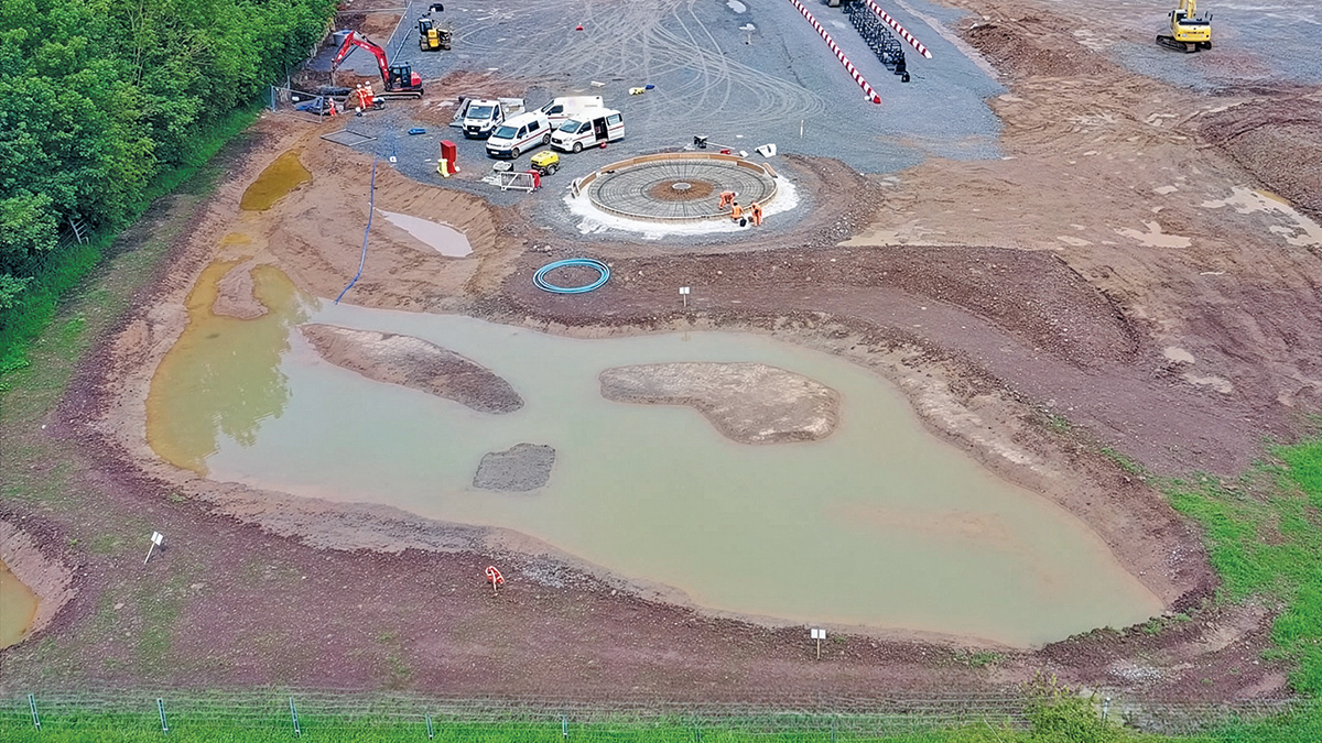
The new wildlife pond scores biodiversity units to help project meet the BNG requirements – Courtesy of Mott MacDonald Bentley
Additional habitat & access features
A public footpath runs along the southern boundary of the site along the bank of the River Strine. As part of the scheme, this footpath is going to be improved, a bridge will be installed over the new outfall into the river and views across the new habitats will be possible. The security fencing that is required around the water treatment works will be located up against the main works compound and will not pass through the new habitat area, allowing for timber stock fencing to be used to delineate the public footpath. This reduces visual impact and allows better views across the habitats from the footpath.
A basking mound will be created with a south facing slope, oriented east-west to maximise sun exposure. The southern slope of the mound will be covered with a gravel and stone mix to provide basking areas for invertebrates and reptiles. The mound will be seeded with a pollen and nectar-producing wildflower mix to support nectivorous invertebrates such as bees, butterflies and moths.
Once construction is complete, woody debris piles and hibernacula constructed from stone, wood, earth and turf will be created to further support a range of wildlife within the new habitats. Other features will include bird and bat boxes, insect hotels and habitat piles.
Biodiversity net gain outcomes
As part of the design objectives and planning requirements, the proposed scheme and associated landscaping were input into the Statutory Biodiversity Metric to assess the changes to the Biodiversity Units (BUs) between the existing site and the new habitats. The existing site comprised of modified grassland used for grazing and scored 1.49 BUs. There was a small area of hard standing that scored zero BUs. An individual tree (0.06 BUs) and a line of trees (0.01 BUs) are present on site and will be retained.
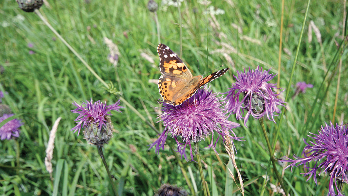
Once established, the ponds will support a range of wildlife – Courtesy of David Naismith
The section of the River Strine that runs along the southern boundary was described as ‘fairly poor’ and has been straightened in the past with steep banks. The photograph on the right shows the location for the new outfall and the existing condition of the banks of the River Strine. As the proposed scheme will be connecting to the river and therefore modifying the bank, River Biodiversity Units would be applicable to the scheme. All other works will be outside the required buffer and therefore not impact the riverbanks.
| Habitat Type | Baseline BU | Proposed BU | BU Change | % Change |
| Area habitats | 1.55 | 2.00 | +0.45 | 28.9% |
| Linear habitats | 0.01 | 0.83 | +0.82 | 5,915% |
| Watercourses | 0.71 | 0.89 | +0.18 | 26.1% |
| Biodiversity Net Gain Summary | ||||
The decision to create a green outfall and surrounding habitat in place of a more traditional pipe and headwall solution will result in a locally important area of habitat to support a range of wildlife. It has also resulted in the new water treatment works meeting the BNG requirements, removing the need for compensatory habitat being created elsewhere.
Once established, this case study will be updated with the habitats and species that will hopefully colonise the site.
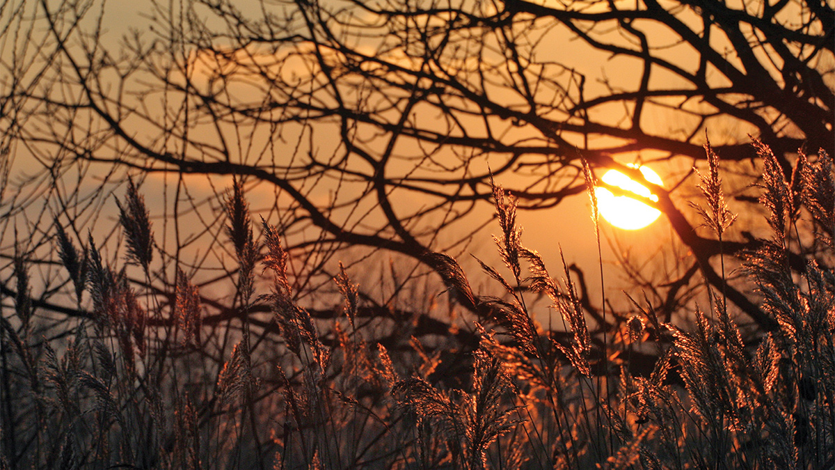
Sunset through willow and reed bed - Courtesy of David Naismith