Ten Acre Impounding Reservoir (2019)
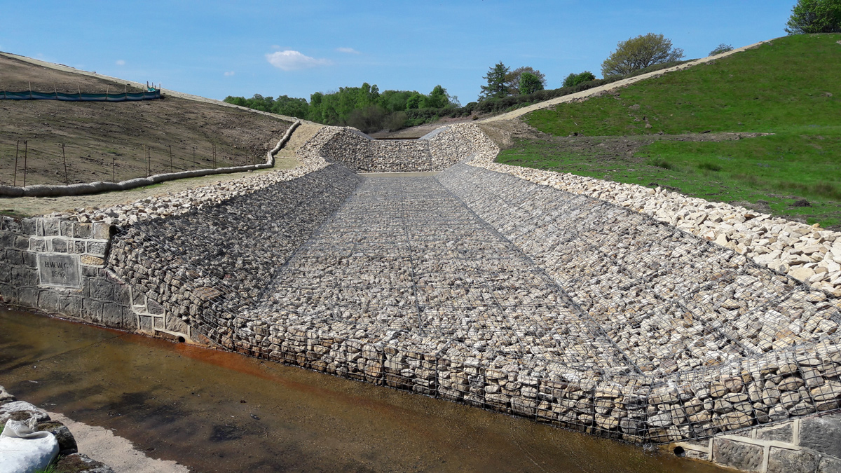
Finished channel - Courtesy of MMB
Ten Acre Impounding Reservoir (IRE), located in Haverah Park near Harrogate, is owned and operated by Yorkshire Water (YWS). The reservoir is impounded by an earth-fill embankment dam, approximately 17m above natural ground level at the highest point, with a capacity of 150,000m3 at top water level. The reservoir was constructed by Harrogate Waterworks Company in 1875 and the reservoir originally fed Harlow Hill Water Treatment Works. Improvements in the reservoir network around Harlow Hill and the limited reliable yield available from Ten Acre has led to the reservoir no longer being used as part of the water supply network.
Introduction
Ten Acre has a historic problem of seepage through the dam. In 2006, a sinkhole was identified on the LHS dam shoulder, which was reinstated. Following the next statutory inspection of the reservoir under the Reservoirs Act 1975, the Inspecting Engineer recommended that a feasibility study should be carried out in order to investigate potential solutions to the internal erosion problem. The investigation works concluded that the dam presents a high risk of internal erosion and that significant investment would be required to make the dam safe. It was therefore agreed with the Inspecting Engineer that the reservoir should be discontinued.
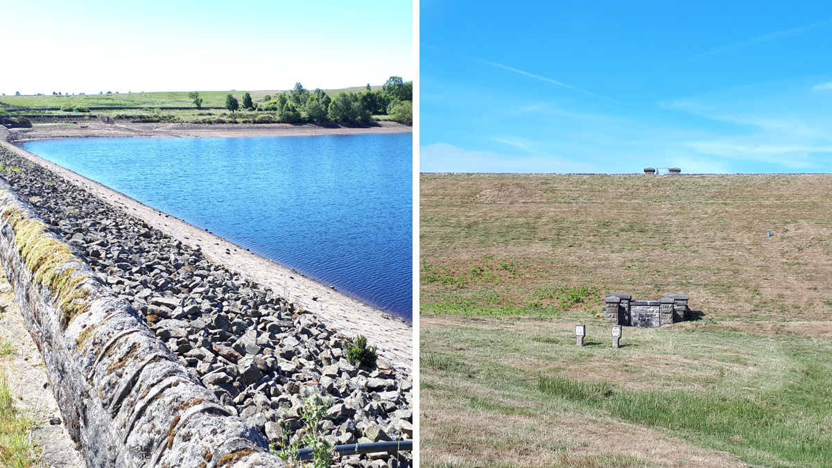
(left) Ten Acre IRE viewed from the left dam shoulder and (right) viewed from the existing spillway channel – Courtesy of MMB
Design
In order to discontinue the reservoir and remove the requirement for ongoing regulation under the Reservoirs Act, the reservoir volume needed to be reduced to below 25,000m3. This involves excavating a V-notch in the existing embankment to lower the top water level of the reservoir and constructing a new stone lined channel to convey flow to the downstream watercourse. The new top water level was set to retain a 5,000m3 body of water, providing a feeding ground to a local bat population.
The V-notch in the dam was designed at a 1 in 4 slope to allow access for construction and maintenance purposes. The excavated material was placed on the downstream face of the embankment to the right of the channel and placed to create a more natural and less engineered profile. 3D modelling in Civil 3D was used to calculate the amount of excavation (8000m3) and to design the profile of the placed material, ensuring that all of the material could be placed in the required area. Model elements were federated in Navisworks to help ensure that the new channel didn’t interfere with the existing scour pipe which needed to remain in operation during the works to control reservoir levels.
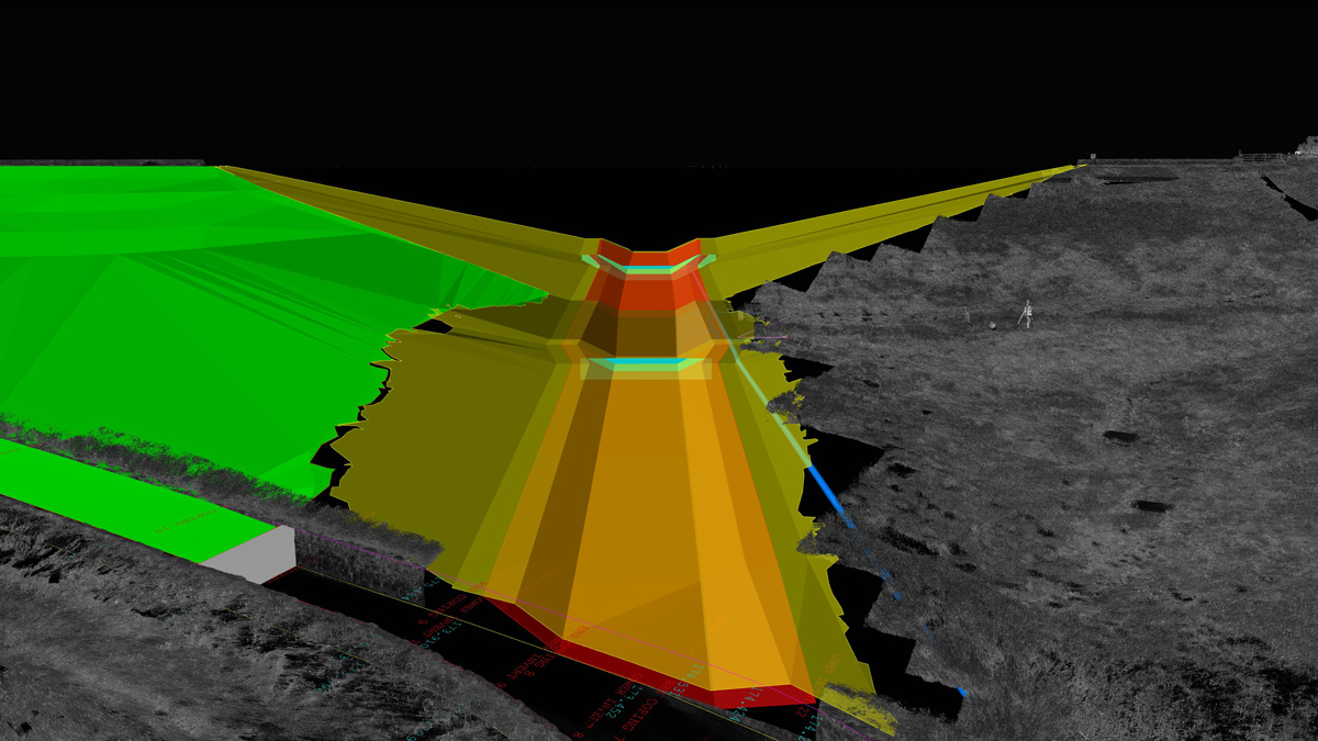
Navisworks model showing the embankment V-notch excavation and new channel with downstream tie-in to the existing spillway channel – Courtesy of MMB
Designing for a natural environment
The design of the discontinuance aims to restore the valley to a more natural environment. The reservoir basin will be left to naturally re-vegetate, allowing native flora to establish as the water level of the reservoir reduces. The existing engineered profile of the dam has been designed to be softened by re-profiling the excavated material on the downstream face, creating a more natural appearance. Scrapes and dragonfly pools have also been designed to be constructed in the exposed reservoir basin to provide further biodiversity enhancement. Shallow open water features are ideal habitat for wading birds such as curlew and lapwing, which are conservation red-listed.
Flood contingency plan
A flood contingency plan (FCP) was developed to protect the excavation works. The existing bywash channel was used to divert flows around the reservoir and flumes were designed to pass a 1 in 150yr flood event, minimising flows into the reservoir. The FCP was split into different construction stages, phasing the excavation works to leave a temporary flood bund downstream of the main weir to protect the excavation of the channel downstream.
The new lower level channel was designed to minimise the amount of excavation and designed to tie into the existing spillway at the downstream end to reuse the existing spillway channel and minimise construction. HEC-RAS was used to produce a hydraulic model of the channel to assess the velocities and water depths across its whole length for a 1 in 150-year flood event flow. A steep section was positioned at the toe of the dam with shallower gradients upstream and downstream to allow rip rap to be used instead of gabion baskets. The first run of the model highlighted that the velocities would be too high for rip rap downstream of the steep section. A weir was then positioned 1m downstream of the toe to force the hydraulic jump to occur earlier, shortening the length of the channel with high velocities and decreasing the amount of gabions required.
The existing stone pitchings and rip rap from the upstream face of the embankment were re-used for the rip rap and gabions rather than importing stone, reducing the carbon footprint of the channel. The original headstone from the scour tunnel was also retained and incorporated into the channel termination detail, maintain some of the heritage of the site.
Construction phase
Drawdown: Works to start preparing for the construction phase began in March 2018, before any mobilisation of personnel to site as the drawdown of the reservoir commenced. To undertake the works, the reservoir needed to be empty of water to allow safe excavation works and to provide protection to local residents of flooding.
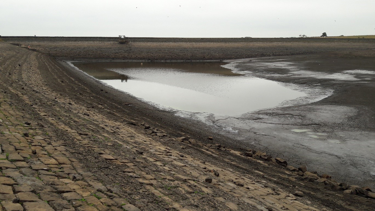
Reservoir level lowered to facilitate the works – Courtesy of MMB
During the drawdown, several environmental considerations had to be taken into account and mitigated against. The main issues included retaining a small volume of water in the reservoir to allow the local bat population to continue to feed, safe removal of fish from the reservoir and implementing measures to control silt released into the downstream water course.
Silt mitigation and pollution prevention was a significant part of the construction works. The reservoir releases water into Oak Beck and following a meeting with the Environment Agency before the works began, an agreed set of water quality parameters for the discharged water were set to ensure there was no degradation to the downstream water course. Turbidity and pH levels were recorded daily on site from collected samples of discharged reservoir water, with site-based equipment, to ensure compliance.
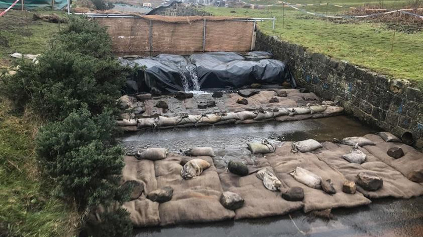
Silt mitigation measures – Courtesy of MMB
Silt mitigation measures were put in place within the existing spillway to reduce the turbidity levels. This included several straw bales, silt capture mattress and silt curtains, all designed to capture silt before it entered the water course. Silt curtains were also installed at the toe of embankment slopes to capture run off from the earth exposed slopes during rainfall events.
Site Access: Works started on site in May 2018 with significant works to improve access off a main road to allow large vehicles to safely turned into the site entrance. The entrance was widened to provide a better turning circle and also to create better visibility when exiting the site. The 1km rough access road from the main road to site was improved with temporary work calculations carried out to install a safe crossing over a high-pressure gas main.
Excavation: The main excavation of the embankment and for the new channel was planned and sequenced in detail due to the small footprint of the site. It was critical excavation work could take place whilst other plant was moving and placing the excavated material on other parts of the site. The excavation work was set out using a smart GPS station that had coordinates inputted directly from the Civil 3D model. By placing the GPS station at any point, it gave a reading of how high or low the ground level was at that exact point. This reduced the amount of setting out errors on site and reduced the duration of the excavation works.
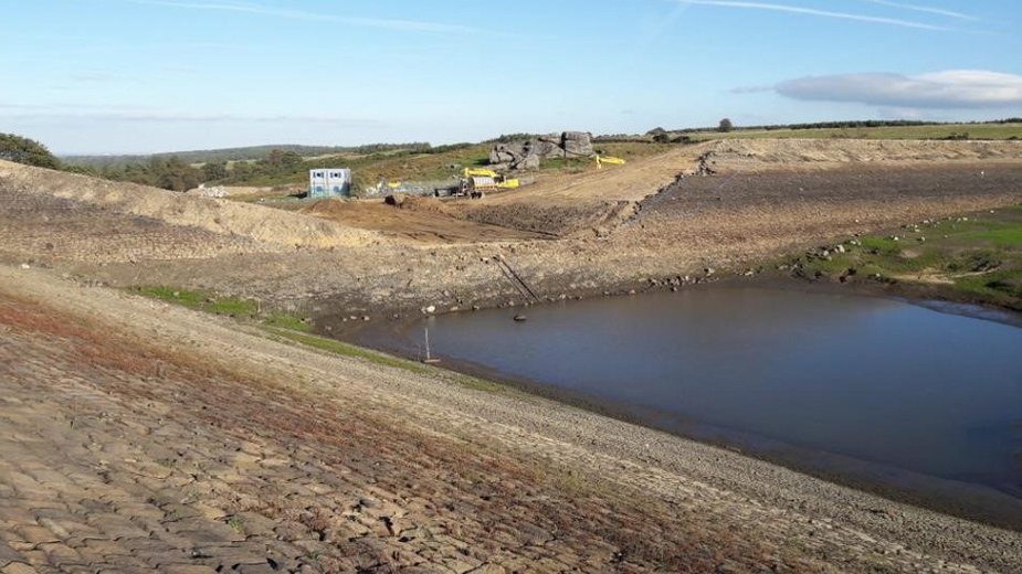
Excavation through the embankment – Courtesy of MMB
Weir structure and channel: The new weir structure was located and constructed in the centre of the existing clay core to provide a water tight cut off from the reservoir to the channel. The clay was over excavated before the concrete weir was cast in the trench.
The channel was formed out of a combination of rip rap and gabion baskets, the downstream sections were installed on top of a waterproof liner to ensure water passed from the reservoir directly into the watercourse. The waterproof liner was installed with a soft geotextile above and below to protect the liner from being punctured by the stone and earth.
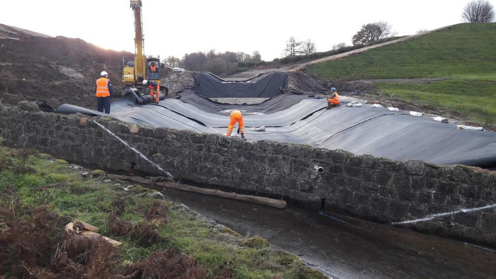
Installation of the liner – Courtesy of MMB
Key design and construction details included ensuring the liner terminated into a tie-in trench at the top of the channel slopes as well as tying into the existing spillway at the downstream end of the channel and the new weir structure at the top end of the channel to provide a water tight channel. Bespoke steel angles were fabricated to tie the liner into the concrete structures.
The gabions were filled mainly with stone reclaimed from the site during the excavation works. The masonry wave wall was removed as well as a number of pitching on the upstream side of the embankment. This stone was crushed on site to a suitable size and used in the gabion baskets.
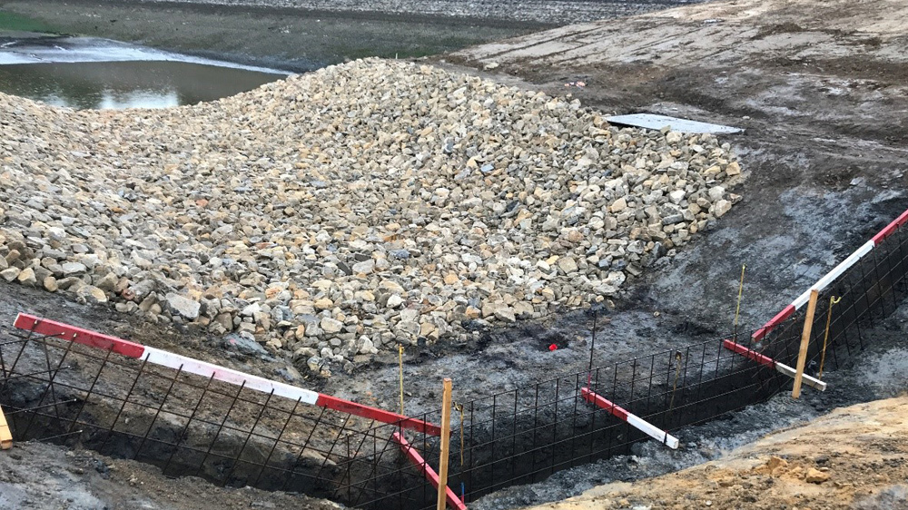
Weir cut off into the clay core – Courtesy of MMB
Commissioning of the channel was a challenging aspect of the scheme. When the reservoir first filled up and overtopped the weir, the water started to wash a lot of the silt and dust from the gabion stone into the downstream channel causing an unacceptable about of turbidity in the watercourse. This led to a change in the commissioning process by lowering the reservoir level and cleaning the channel with water pumps. The silty water was captured in a bunded off area at the end of the channel and following discussions with the Environment Agency on site, the water was pump to a nearby section of wasteland and left to naturally silt through the ground. Once the channel was sufficiently manually cleaned the reservoir was allowed to refill.
Conclusion
The site was demobilised in May 2019 after successful completion of the scheme. Both the client, Yorkshire Water and the QCE overseeing the project commented on the quality of the work and the success of the finished scheme in delivering the desired outcome of discontinuing the reservoir to improve reservoir safety.
Over the coming years the grass will grow on the reprofiled embankment slopes and the discontinued reservoir basin will be left to naturally vegetate and allow new wildlife habits to develop.
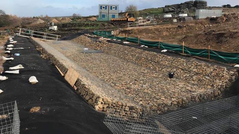
Installing gabion baskets – Courtesy of MMB
Following a post project review the main successes were in using 3D modelling to aid both design and construction, the reuse of materials on site and the environmental mitigation process put in place. These learnings around silt mitigation and environmental considerations will be taken forward into future schemes.


